.png)
 German (DE)
  English (US)
  Spanish (ES)
  French (FR)
  Hindi (IN)
  Italian (IT)
  Russian (RU)
  6 hours ago
2
6 hours ago
2
NEWYou can now listen to Fox News articles!
In the wake of the catastrophic July Fourth floods that barreled through south central Texas, claiming 119 lives and leaving nearly 200 people missing, NASA dispatched two aircraft to aid local recovery efforts and search and rescue operations.
NASA's high-altitude WB-57 aircraft took off from Ellington Field Joint Reserve Base in Houston on Tuesday, and will conduct aerial surveys using its DyNAMITE (Day/Night Airborne Motion Imager for Terrestrial Environments) sensor.
The sensor will take high-resolution photos of the Guadalupe River and several miles of the surrounding area, which could accelerate emergency response times.

A NASA WB-57 plane will be assessing flood damage and aiding with recovery efforts after catastrophic flooding in Texas. (Raquel Natalicchio/Houston Chronicle via Getty Images)
The aircraft are responding as part of NASA’s Disasters Response Coordination System, which was activated to support the flood emergency response in coordination with the Texas Division of Emergency Management, Federal Emergency Management Agency (FEMA), and humanitarian groups.
"Persistent cloud-cover has made it difficult to obtain clear satellite imagery, so the Disasters Program coordinated with NASA’s Airborne Science Program at NASA’s Johnson Space Flight Center in Houston to conduct a series of flights to gather observations of the impacted regions," according to a NASA statement.
Officials said the data will be provided to response teams and aid in rescue efforts and resource allocation.
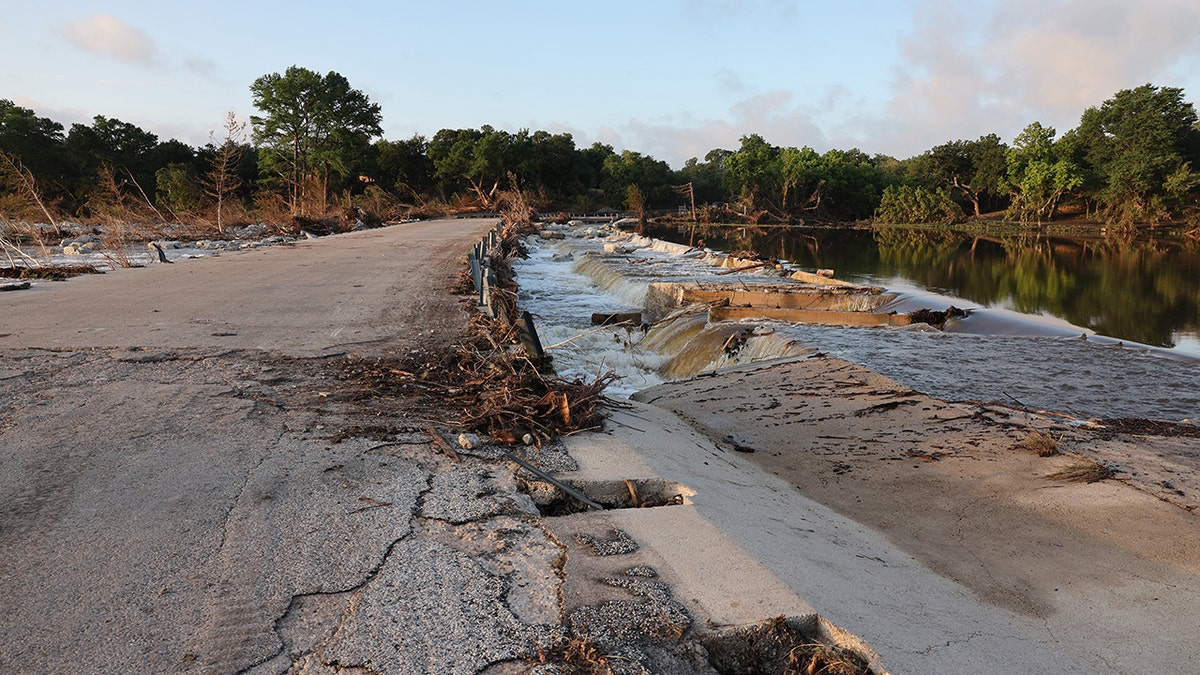
Indian Creek Road with extensive damage in Kerrville, Texas, on Tuesday, after heavy rain caused flash flooding on July 4 across the south central part of the state, devastating the area. (Derek Shook for Fox News Digital)
The agency also sent its Uninhabited Aerial Vehicle Synthetic Aperture Radar (UAVSAR), aboard a Gulfstream III, from NASA’s Armstrong Flight Research Center in Edwards, California, on Wednesday to collect observations over the Guadalupe, San Gabriel and Colorado river basins.
UAVSAR, which can spot water through vegetation, will be collecting data through the end of the week.
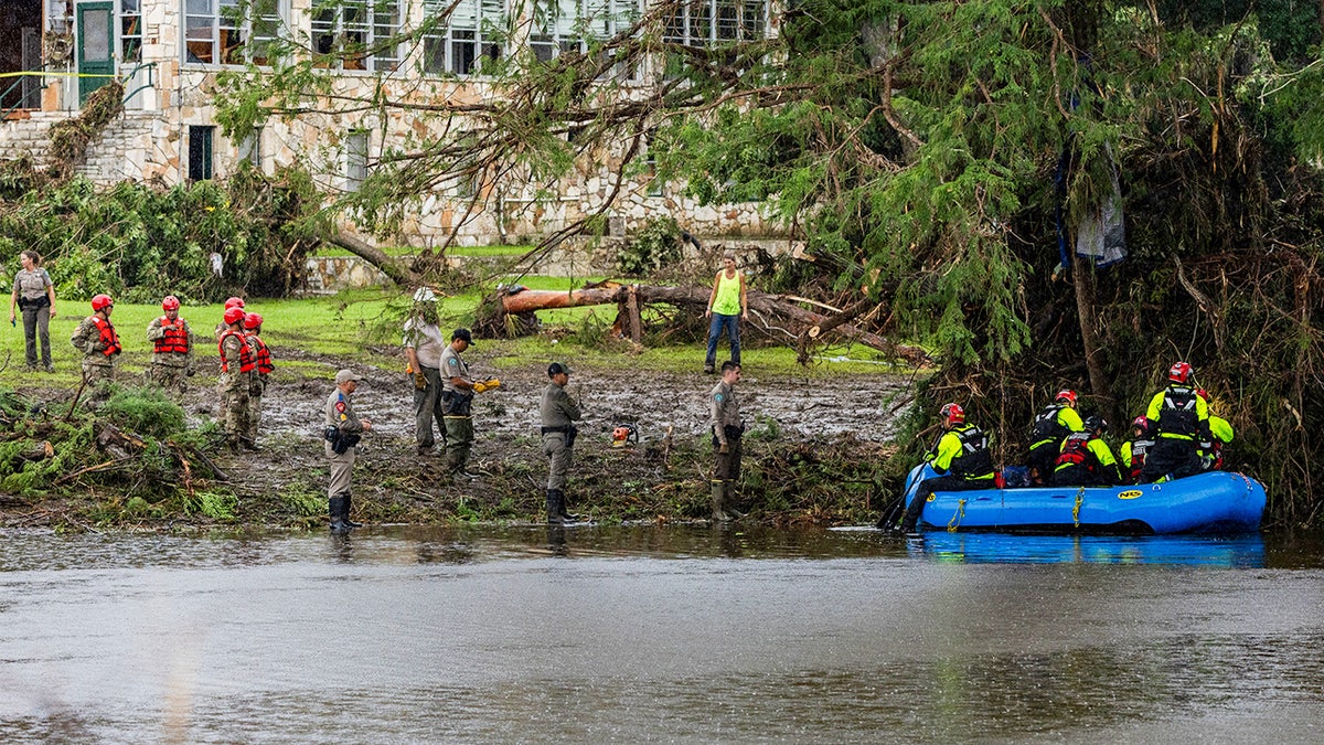
Workers dig through debris looking for any survivors or remains of people swept up in the flash flooding at Camp Mystic in Hunt, Texas. (Jim Vondruska/Getty Images)
"The team’s goal is to characterize the extent of flooding to help with understanding the amount of damage within communities," according to the statement.
CLICK HERE TO GET THE FOX NEWS APP
The disasters program will create maps to analyze the severity of flooding and damage to buildings and infrastructure, which will be shared on the NASA Disasters Mapping Portal as they become available.
Alexandra Koch is a breaking news writer for Fox News Digital. Prior to joining Fox News, Alexandra covered breaking news, crime, religion, and the military in the southeast.


Comments